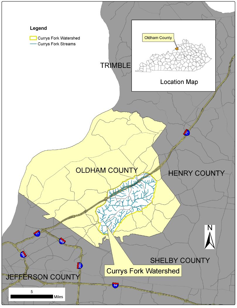
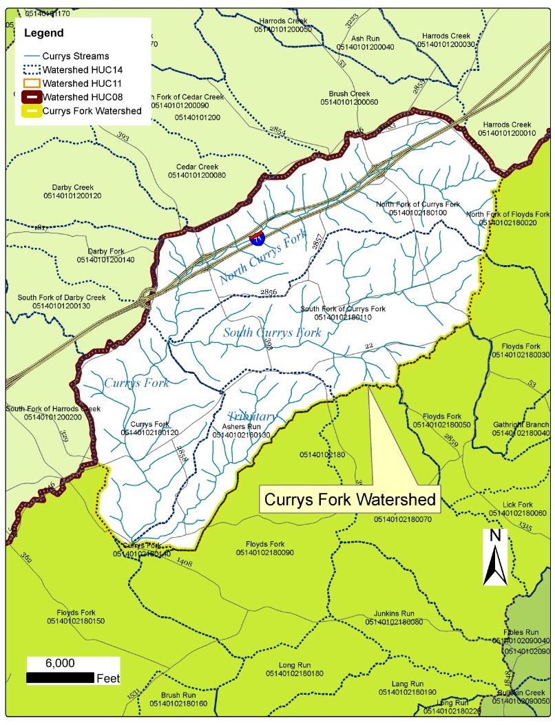
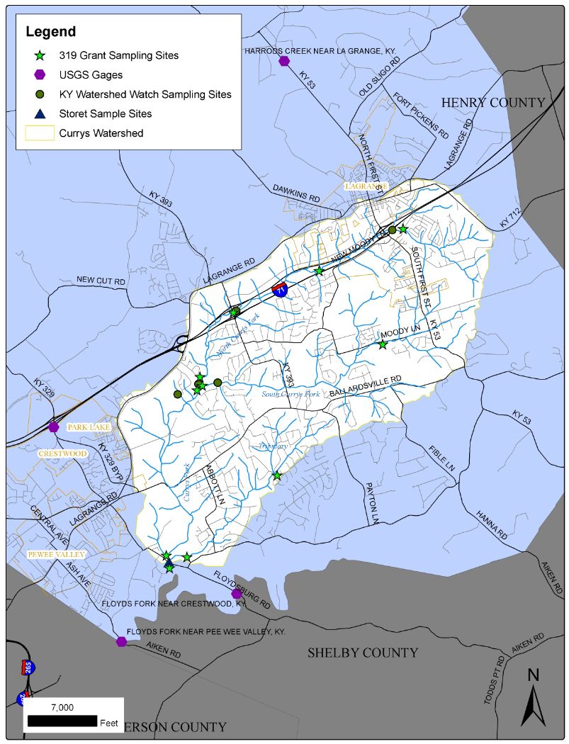
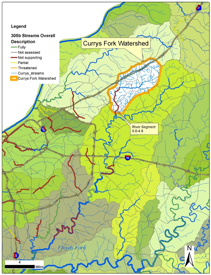
Currys Fork Watershed Maps
The following are a series of maps to help you better understand where the Currys Fork watershed is, land use within the watershed, sampling locations within the watershed, and other information. Click the image of the map to see an enlarged picture.
|
Currys Fork Location
|
Currys Fork Subwatersheds
|
Currys Fork Sampling Points
|
|
Impaired Streams on 303(d) List
|
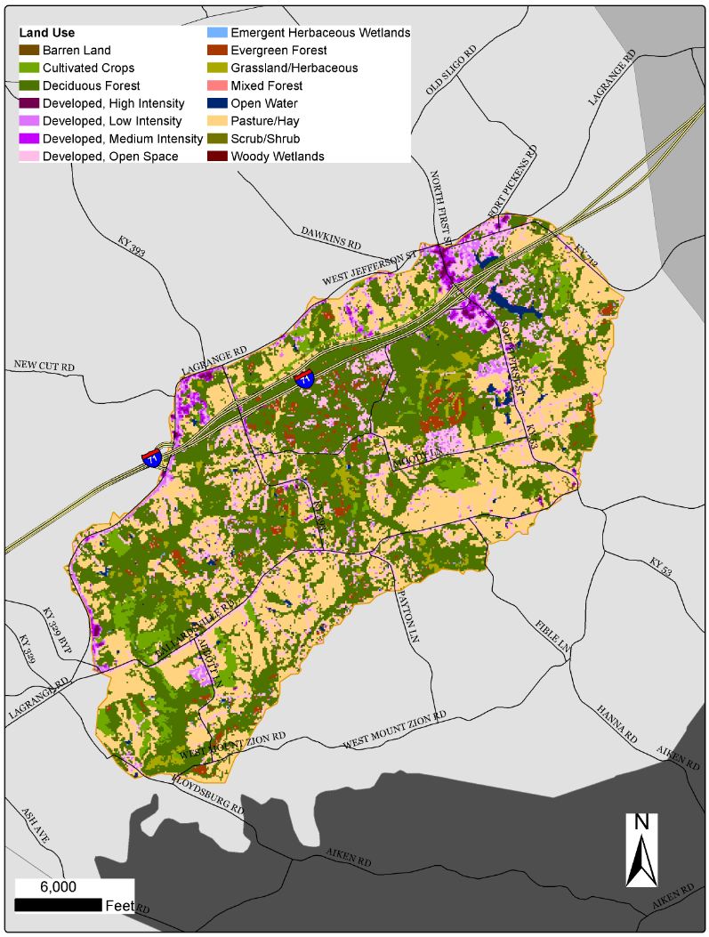
Currys Fork Land Use
|
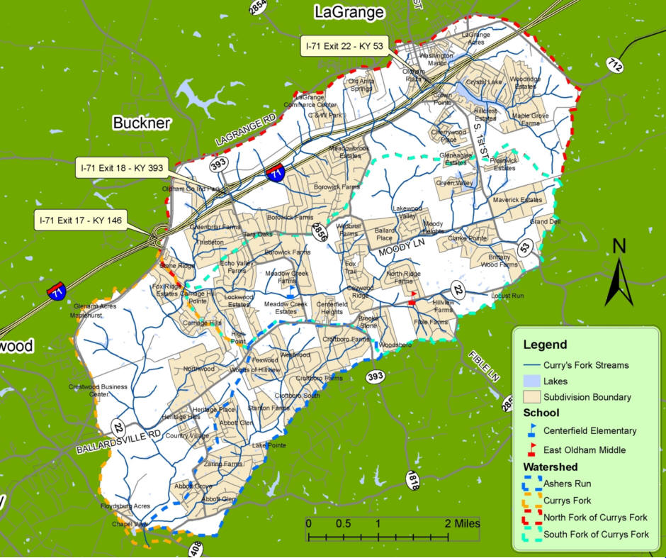
Currys Fork Subdivisions and Watershed Boundaries |